Buoyage
Tuesday, 22 November 2016
As explained in the previous page buoys and other navigation marks are positioned in relation to the left bank and right bank; green buoys and marks depict the left bank or left-hand side and red buoys and marks depict the right bank or right-hand side. This page is only a simplistic description and for more detailed information it is better to refer to the RYA book of European Waterways Regulations where e.g. the various possible associated lights are described as well.
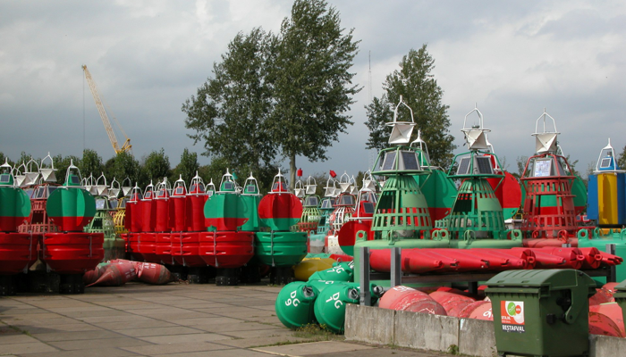
For aid in poor visibility (or for people with red-green colour blindness) green/port buoys are conical in shape and red/starboard ones are cylindrical. These shapes are used to distinguish topmarks as well. Old buoyage may still be encountered which uses black instead of green.
CHANNEL MARKS
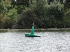
The left-hand side of the channel may be marked with green conical buoys or buoys/spars with a conical topmark.
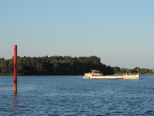
The right-hand side of the channel may be marked with red cylindrical buoys or buoys/spars with a cylindrical topmark
Bifurcation or division of the channel may be marked with red and green horizontal striped spherical buoys or buoys/spars with a spherical topmark.
If there is a preferred or main channel this might be indicated by the addition of a green cone or red cylinder as appropriate. Passage is still permitted either side, but for the main deep water channel they should be regarded as left-hand or right-hand buoys as shown by the topmark.
OBSTACLE MARKS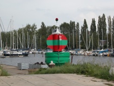
Fixed marks are cones or triangular boards on a post. Left-hand marks are green and point up, right-hand ones are red and point down.
Bifurcations are red over green cones/triangles.
Buoyage: left-hand is green/white horizontal striped spars or spar buoys with a green cone topmark, right hand is red/white horizontal striped spars or spar buoys with red cylindrical topmark.
OTHER MARKING OF DANGER POINTS AND OBSTACLES
Passage permitted on the clear side without reduction of speed: a float showing a “no entry” sign (horizontal red,white.red stripes) on the obstructed side and an “entry permitted” sign (vertical green, white, green stripes) on the clear side.
Passage permitted on the clear side at reduced speed: a float showing one red flag or board on the obstructed side and a “make no waves” red over white flag/board on the clear side.
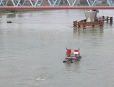
Bridge Piers may be marked by yellow floats with a radar reflector, or radar reflectors on a pole upstream and downstream of the piers.
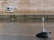
FLOOD MARKS
Major rivers use flood marks showing a reference mark and a Roman numeral. Some rivers will be closed to navigation when level II is reached, while on others such as e.g. the Moselle it is level III. In France they are identified with the initials PHEN (Plus hauts eaux navigables - highest level for navigable waters))
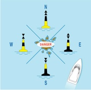
Cardinal marks
“The four quadrants north, east, south and west are bounded by the true bearings NW-NE, NE-SE, SE-SW, SW-NW taken from the point of interest. The cardinal mark is named after the quadrant in which it is placed and indicates that the mark should be passed on the side of the quadrant named”.
What this means in practice is that should you encounter such mark or marks, in order to remain in safe waters you should pass to north of the north cardinal, east of the east cardinal, south of the south cardinal, west of the west cardinal.
(diagram Pete Galvin/RYA)
RESTRICTED AREAS
are marked by yellow buoys. The nature of the restriction or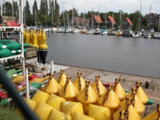 prohibition will generally be made clear on charts, by markings on the buoy, or signage on the bank. A zone where navigation is totally prohibited may be marked by a rigid red pennant on the buoys.
If such prohibited or restricted area is crossed by a channel permitting vessel to pass, the upper half of the two buoys at the entrance may be coloured red on the right-hand side of the entrance and green on the left-hand side, as seen by the boatmaster leaving the channel.
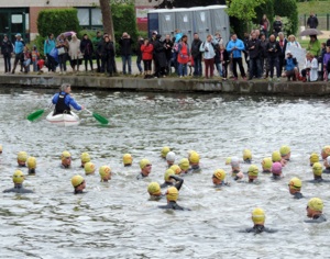
In France spherical yellow buoys are generally used to mark an area reserved for bathing, and conical yellow buoys delineate one form of activity from another.
(not to be confused with yellow boys, of course)
link to Tam’s RYA Book of CEVNI Regulations and DVD Barge Handling in France
(All text and photographs copyright © Tam & Di Murrell unless otherwise credited)